Roofing & building inspection

Plan the roof, fly it, deliver the files.

Plan the capture over the building, process the photos into a map with SkyPLX-9, and share the files with your client or engineer.

Inspection footage from a working drone operator.

A real roof

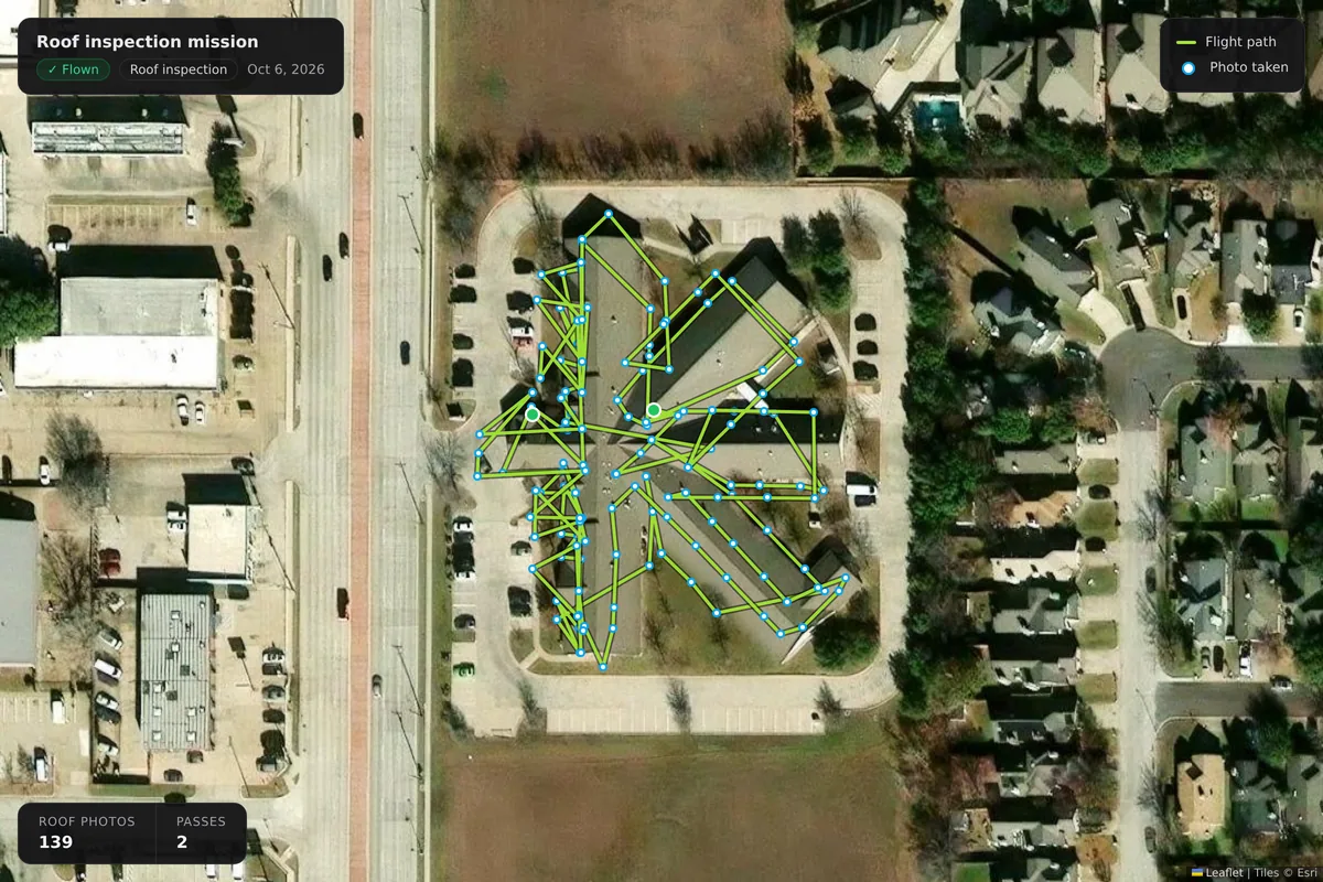
Every photo over the building

This is a roof we flew in October 2026, from our own account. Each dot is a photo, in the order it was taken, across two passes over the building; 139 photos in all. Upload them to the mission and SkySuite keeps them with the job.

  • Photos uploaded to the mission
  • Every photo kept with the job
The flight path of a real roof inspection flown on October 6, 2026: 139 photo positions in two passes over a cross-shaped commercial roof, drawn over satellite imagery.

Capture

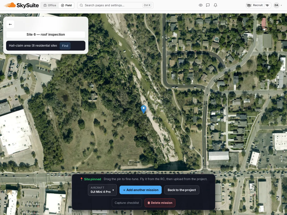
Plan a route for the property

Draw the area over satellite imagery in the planner and choose the overlap, altitude and camera angle. The route is generated for you; check it, then send it to the controller or export the KMZ.

  • Area drawn over satellite imagery
  • Overlap, altitude and angle set by the pilot
  • Send to the controller or export a KMZ
SkySuite flight planner: a roof-inspection site pinned on satellite imagery of a residential street, ready to add the mission and send it to the controller.

Review

Share images and survey outputs

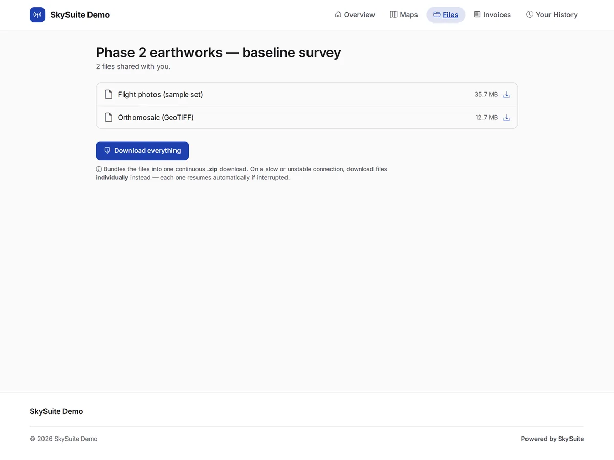
Process the photos into an orthomosaic with SkyPLX-9 and share the files through a client link, ready for your engineer or inspector to review the roof and sign the report.

  • Orthomosaic processing with SkyPLX-9
  • Client file review
The client delivery portal's Files tab: shared flight photos, an orthomosaic GeoTIFF and a survey report, with download buttons and Download everything.

Keep the capture and delivery organized.

Free never runs out. No card required. Try Pro free for 14 days, or 30 days with a card. Plan your next roof today, or book a demo and we'll plan one with you.

Comparing plans? See plans & pricing.